16 days, 4 states, 3,850 miles
7/20/13
The entire trip is evenly divided between getting to and from Colorado and riding in Colorado – 2,000 miles each. I don’t expect riding through Iowa and Nebraska to be overly exciting, but at this point I cannot think of any other way to get to Colorado. Teleportation would be a nice option, but at&t still doesn’t offer this service in my area.
Once in Colorado, we’ll try to hit the most popular places: Mt. Evans and Pikes Peak, Garden of the Gods, Royal Gorge Bridge, Black Canyon, Mesa Verde, Colorado National Monument, Estes Park, and a bunch of scenic lakes high in the mountains. The most famous roads such as San Juan Skyway, Peak to Peak Scenic Byway, and Top of the Rockies Byway are also part of the route.
This time I deviated from my habit of using a Falcon’s book from the Scenic Driving series as my primary source of information and instead relied on several other books including The Most Scenic Drives in America from Reader’s Digest, Guide to Scenic Highways & Byways from National Geographic and Motorcycle Touring in Southwest by Christy Karras.
The result of this effort was 28 scenic roads to ride and a dozen special places to visit. We are also planning on exploring at least some of the places we will be staying in such as Denver, Colorado Springs, and Boulder.

Scenic roads mapped using Microsoft Streets & Trips.

After a lot of deliberation and multiple versions, this is what has emerged as a final route.

Altitude sickness is obviously a concern. The route takes us to the top of Mt. Evans while riding from Denver to Colorado Springs on day 4. This is a 7,500 foot difference in elevation. Mt. Evans is just 53 miles from where we will be staying in Denver. Even traveling at 25 mph we will get to the top in 2 hours.
The only advice I found for trying to prevent at least some symptoms of altitude sickness is to stay hydrated and take Tylenol. A Camel Bag would be nice to stay hydrated, but it’s not an option when you wear a full-face helmet.
8/05/13
Days 1, 2, 3 Chicago - Fort Dodge (IA) - Kearney (NE) – Golden (CO) (1,045 mi)
We left Howard’s home at 8:30 AM, took I-90 West and set for a 3-day long trip to Colorado. We encountered a little bit of rain on the first day, but other than that the weather cooperated with temperatures fluctuating between 60F and 85F.
It was too early for dinner when we arrived in Denver, so we decided to explore its downtown. We found it to be very attractive and not extremely busy, even during rush hour. We parked our bikes and walked up and down 16th St Mall. As you would expect – a lot of coffee shops, restaurants and places to buy souvenirs.
Downtown Denver


Day 4 Golden - Colorado Springs (200 mi)
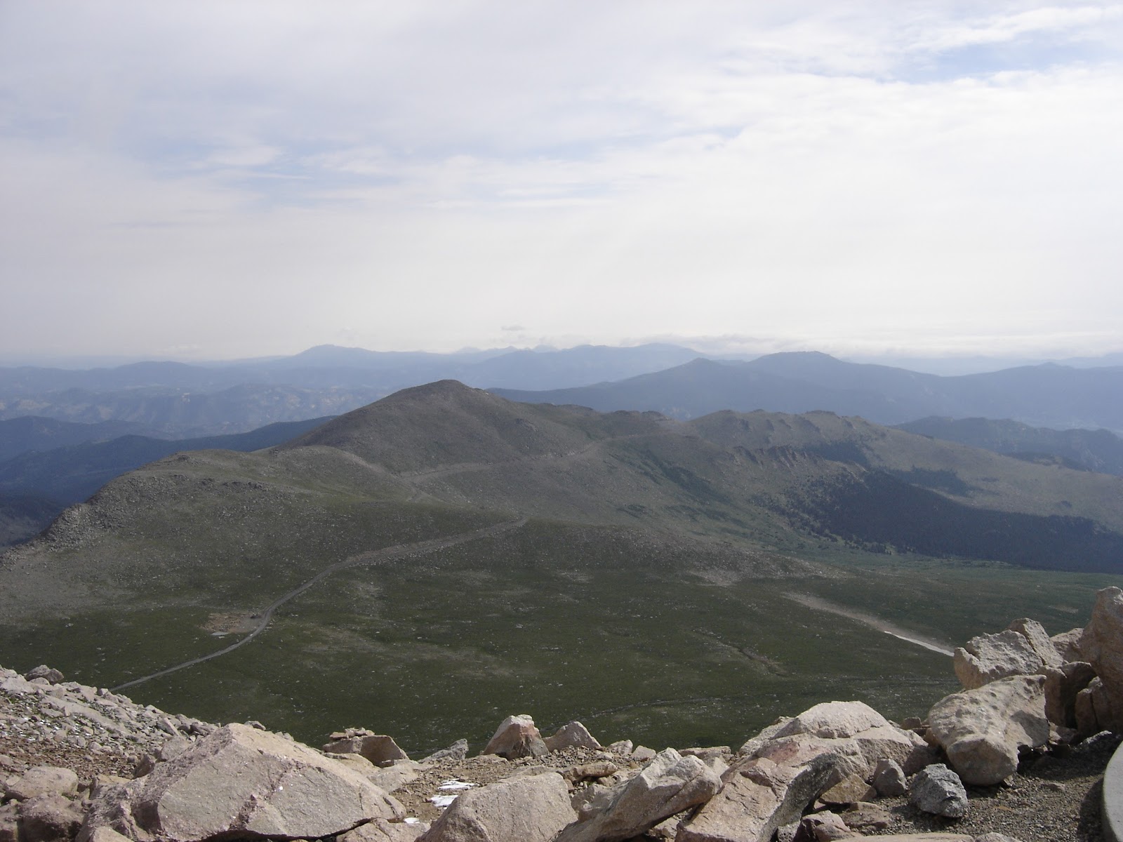
The main attraction was of course Mt. Evans. All my fears about altitude sickness turned out to be unfounded. Neither my bike (2006 Suzuki Burgman 650) nor I experienced any difficulties at 14,000 feet above see level. For some reason Howard’s Silverwing, despite being fuel-injected, didn’t like high altitude. But the issue was more of a nuisance than a real problem and didn’t alter our plans.
The road to the top of Mt. Evans was breathtaking. It’s about 28 miles long and climbs from 8,700 feet at Idaho Spring on I-70 to 14,240 feet to the summit. Despite the road being paved it looked very natural. No luxuries such as perfect surface or guardrails. It’s also the highest paved road in North America.

Satellite view of the last several miles of Mt. Evans Scenic Byway
Absolutely unexpected for us was the number of bicyclists climbing Mt. Evans. It definitely exceeded the number of cars.
Mt. Evans


In Denver I dropped my GPS and cracked the screen. Fortunately I had a spare one with me. It took three hours to update maps via a slow internet connection at the Hyatt, but by the end of the day I had new maps and routes installed and ready to go.
Day 5 Colorado Springs - Canon City (150 mi)
We started the day with a ride through the Garden of the Gods. It was interesting, but since the next item on the itinerary was Pikes Peak, we kind of rushed through it.
Garden of the Gods


Pikes Peak is definitely more civilized than Mt. Evans. The road is in much better shape, there are guardrails and a gift shop at the summit. There’s also more traffic.
One annoyance and a safety hazard was Bike Tour operators. They would bring a dozen people and bikes to the summit in a van and then allow them to ride down the mountain. But I’m not sure that sharing a narrow road with hairpin turns with the white-knuckled drivers is such a great idea.

Satellite view of the Pikes Peak Highway
Pikes Peak (14,110 feet above sea level)


The next stop was Royal Gorge Park & Bridge. The bridge stands 955 feet above the Arkansas River and is regarded as the highest suspension bridge in the United States.
Unfortunately the park was closed because of the fire that broke out near Canon City in June, which destroyed almost everything except for the bridge. An antique carousel, an aerial tram and the park's visitor center were among the structures that were lost in the fire. The bridge remained unharmed except for 32 of the 1,292 burned wooden planks on the south end.
We were directed to the edge of the gorge outside of the park where we took several pictures.
Royal Gorge Park and Bridge


All local TV channels were reporting a flash flood that swept out of the Waldo Canyon and into Manitou Springs Friday afternoon. A rock and mudslide also closed U.S. 24 in the Cascade area northwest of Manitou Springs.

We rode through the town in the morning on the way to Pikes Peak.
Day 6 Canon City – Delta (220 mi)
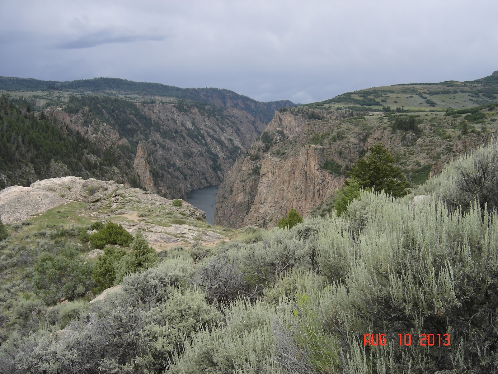
U.S. 50 out of Canyon City took us to the bottom of Royal Gorge along Arkansas River and Royal Gorge Route Railroad. We then turned right on Hwy 92 after Blue Mesa Reservoir on Gunnison River and rode along the rim of Black Canyon.
Black Canyon of the Gunnison National Park


Day 7 Delta – Durango (170 mi)


Ouray


It should be noted that in its early days Silverton was a fun place with 32 saloons and gambling halls in a three block stretch.
Of course the main consideration when selecting a hotel is the ability to cancel reservation the same day.
Day 8 Durango – Ridgway (220 mi)
Ridgway was the set of John Wayne's western movie True Grit, and others including How the West Was Won and Tribute to a Bad Man.
Trail Town Still – moonshine with a license. This place was across the street from our lodge. Once we walked in, all the rules about not drinking on a trip went out of the window. They had the best whiskey I’ve ever tried.
To our surprise the owner of a pizza place called Panny’s Pizza told us that she does 4x more business in the Summer than in the Winter. We expected the opposite with Telluride less than 40 miles away and the hotels in Ridgway offering free shuttle and discount lift tickets.
Day 9 Ridgway - Grand Junction (205 mi)


We stayed at Day’s Inn in Delta. It wasn’t a 5-star establishment, but it had a no-name restaurant attached to it serving out-of-this-world blueberry pies.
Day 7 Delta – Durango (170 mi)
We couldn’t resist and took East Portal Road down to the bottom of Black Canyon.
Black Canyon - Gunnison River


Sun Juan Skyway (U.S. 550) is one of the most scenic roads in Colorado with a 25-mile section between Ouray and Silverton, called the Million Dollar Highway, which offered probably the most breathtaking views.
Ouray is nested in a narrow, steeply walled valley. It’s population is less than a thousand. Streets are lined with Victorian hotels, shops and restaurants. A big attraction is a public pool fed by hot springs.
Ouray


Silverton is another old mining town set between high mountain walls. Similar to Ouray it offers primarily dining and souvenirs. One exception is Durango & Silverton Narrow Gauge Railroad that carries tourists from Durango to Silverton and back on a train pulled by a vintage steam locomotive.
It should be noted that in its early days Silverton was a fun place with 32 saloons and gambling halls in a three block stretch.
Silverton


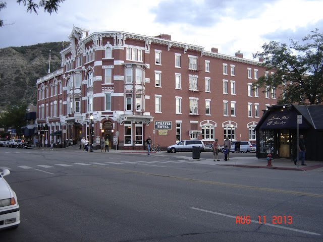
Durango’s downtown is small and cute with restaurants and shops. We went to T's Smokehouse & Grill for dinner. If you count calories, forget it, but if you don’t, its BBQ Beef, Sweet Potato Logs and Fried Corn on the Cob are very good.
Durango


For this trip I booked 15 hotels, everything from Hyatt and Courtyard to Day’s Inn and La Quinta. Our best experience was with newer or refurbished hotels operated by choicehotels.com – Comfort Inn & Suites and Quality Inn & Suites. They were the most comfortable, conveniently located, well-maintained and provided more bang for the buck than other hotels.
Of course the main consideration when selecting a hotel is the ability to cancel reservation the same day.
Day 8 Durango – Ridgway (220 mi)
Mesa Verde National Park was our first stop of the day with Cliff Palace as the main attraction. The palace was built by the Ancient Pueblo People about 750 year ago.
Mesa Verde National Park


We continued on Hwy 145 to Ridgway, another old mining town situated in the Uncompahgre Valley with Mt. Sneffels overlooking the town.
Ridgway was the set of John Wayne's western movie True Grit, and others including How the West Was Won and Tribute to a Bad Man.
Trail Town Still – moonshine with a license. This place was across the street from our lodge. Once we walked in, all the rules about not drinking on a trip went out of the window. They had the best whiskey I’ve ever tried.
To our surprise the owner of a pizza place called Panny’s Pizza told us that she does 4x more business in the Summer than in the Winter. We expected the opposite with Telluride less than 40 miles away and the hotels in Ridgway offering free shuttle and discount lift tickets.
Ridgway


Day 9 Ridgway - Grand Junction (205 mi)
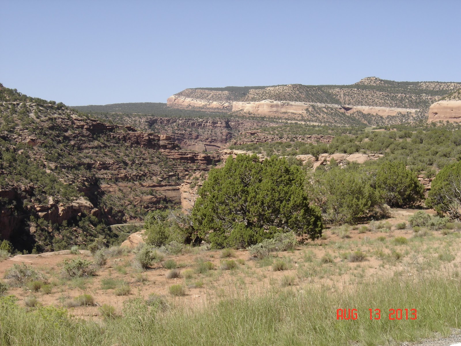
Hwy 141 is a never ending canyon with the walls changing characteristics from granite boulders to huge slabs of red rock.
Hwy 141


Colorado National Monument is several spectacular canyons cut deep into sandstone and even granite rock formations with towering red rock structures.
Colorado National Monument


Day 10 Grand Junction – Carbondale (160 mi)
We had dinner at The Goat, a Mediterranean cafe, that was relatively busy at that hour - always a good sign. I tried lamb gyros and was not disappointed.
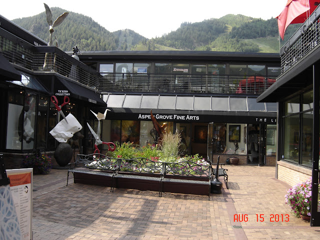
Aspen


It doesn’t look like Grand Junction visitors realize they are in a desert. There are signs in town reminding people to drink a lot of water.
Day 10 Grand Junction – Carbondale (160 mi)
Hwy 65 took us through Grand Mesa National Forest - the largest flattop mountain in the world reaching heights of 11,000 feet.
Grand Mesa


We stopped in Cedaredge, a town of 2,000, for our morning coffee. If not for a sign by the road, we would have missed it. The coffee shop, The Coffee Barn, was housed in a small house that didn’t provide any clues that it was selling coffee. But the espresso was great. We also met a couple of locals who were very enthusiastic about the area.
Cedaredge


Hwy 133 was just another breathtaking road. I had to fight the urge to stop every 5 minutes to take a picture.
Hwy 133


Downtown of Carbondale was small and looked sleepy. We stopped at a food co-op to try local peaches. They were really good but somewhat overpriced.
We had dinner at The Goat, a Mediterranean cafe, that was relatively busy at that hour - always a good sign. I tried lamb gyros and was not disappointed.
The first stop was Aspen. We got there early in the morning before the town woke up. We rode our bikes around, stopped for coffee and a blueberry cone at Annette’s Mountain Bake Shop and continued our trip on Hwy 82 towards Independence Pass on the Continental Divide in the Sawatch Range.
Aspen


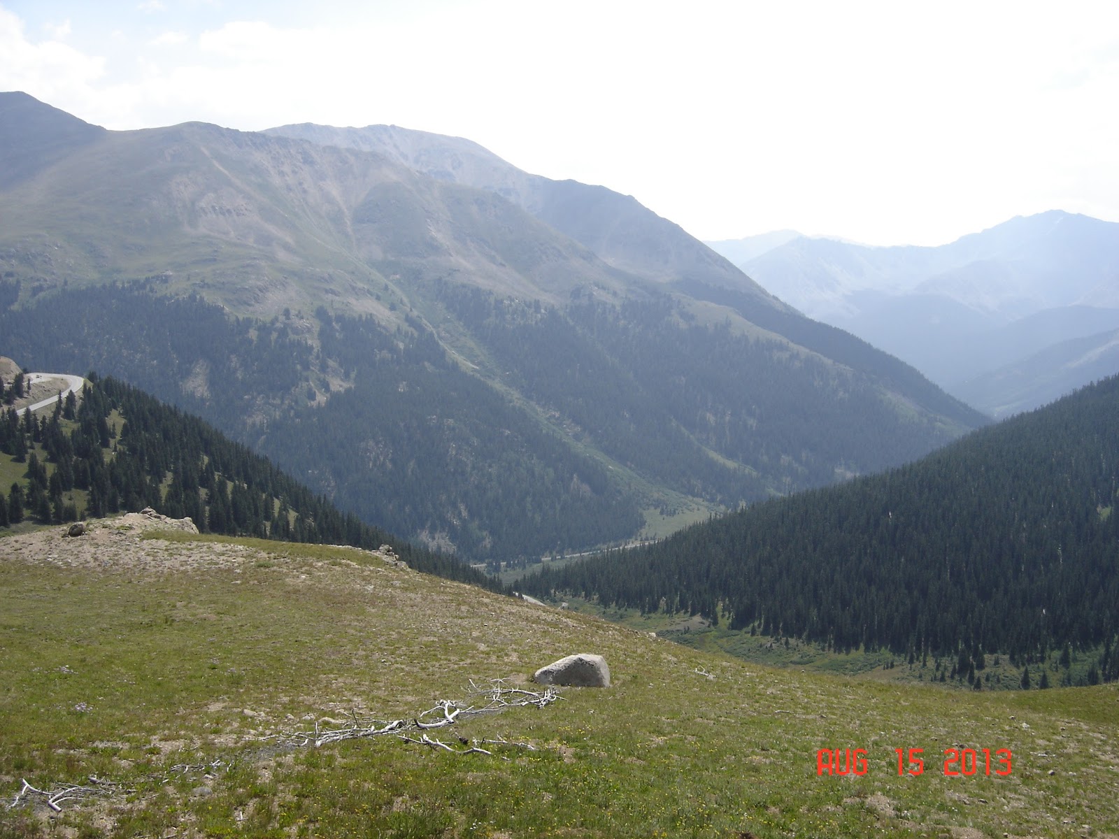
Top of the Rockies Byway (Hwy 82) reaches altitudes of more than 2 miles above sea level and passes near Colorado’s highest peaks. It reaches the Continental Divide at 12,095-feet.
Independence Pass on Continental Divide


Bear Lake parking is relatively small. There’s an overflow parking 2-3 miles below the lake with shuttle buses taking tourists up the mountain to the lake. Howard and I rode to the top guessing right that there was a dedicated motorcycle parking.
Motorcycle boots are not a good substitute for hiking boots, but we still decided to hike half a mile to the Nymph Lake.
Days 14, 15, 16 Fort Collins (CO) - Kearney (NE) - Grinnell (IA) – Chicago (1,125 mi)


Day 12 Boulder - Fort Collins (185 mi)
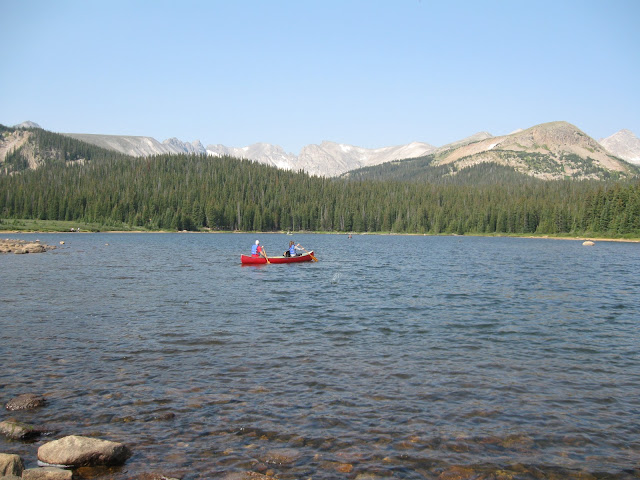
We rode south-west on Hwy 119 until we reached Nederland and then turned north on Peak to Peak Hwy (72.) We detoured to take a picture or two of Brainard Lake.
Brainard Lake


Late morning coffee and country music. If you know anything better than that, please let me know. Coffee was actually not that bad.
Lyons


Day 13 Fort Collins (115 mi)
After 12 days of riding, we decided to take it easy and cut this day’s route in half. A little bit of hiking was exactly what we needed. We spent some time in Estes Park and proceeded to the Rocky Mountain National Park.
Estes Park


All Colorado parks charge $5-10 entry fee, but it looks like they spend money wisely. Everything is in great shape and well organized.
Bear Lake parking is relatively small. There’s an overflow parking 2-3 miles below the lake with shuttle buses taking tourists up the mountain to the lake. Howard and I rode to the top guessing right that there was a dedicated motorcycle parking.
Motorcycle boots are not a good substitute for hiking boots, but we still decided to hike half a mile to the Nymph Lake.
Bear & Nymph Lakes


27,000 kids will make a town, even one as big as Fort Collins, alive and vibrant. I think we saw the entire CSU campus on Friday night.
Fort Collins


Days 14, 15, 16 Fort Collins (CO) - Kearney (NE) - Grinnell (IA) – Chicago (1,125 mi)
Grinnell surprised us with an upscale restaurant in a converted railroad depot.
The Peppertree at The Depot Crossing


Epilogue
After traveling 2,000 miles through the most beautiful parts of Colorado, it would be nice to slow down and do a little bit of hiking, rent a Jeep and ride back roads in San Juan Mountains, explore those little towns or simply seat in a cafe with a cup of coffee without rushing anywhere. Maybe next year.
No comments:
Post a Comment